Webinar on GIS Career Opportunities
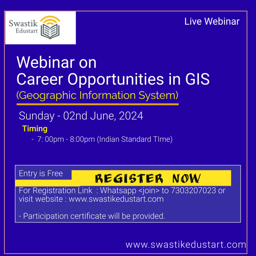
Free Registration Topic : Career Opportunities in GIS Date : 2nd June, 2024 (Sunday) Time : 7:00 PM (Indian Standard TIme) Registration Link : https://forms.gle/gvBnoPSB5ueW3CRD7
Your blog category
Free Registration Topic : Career Opportunities in GIS Date : 2nd June, 2024 (Sunday) Time : 7:00 PM (Indian Standard TIme) Registration Link : https://forms.gle/gvBnoPSB5ueW3CRD7
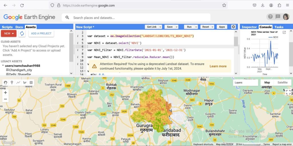
Geographic Information Systems (GIS) have revolutionized how we understand and interact with the world around us. Among the various tools available to GIS professionals and enthusiasts, Google Earth Engine (GEE) stands out as a transformative platform, offering unparalleled capabilities for environmental monitoring, spatial analysis, and decision-making. Here’s why Google Earth Engine is so crucial in
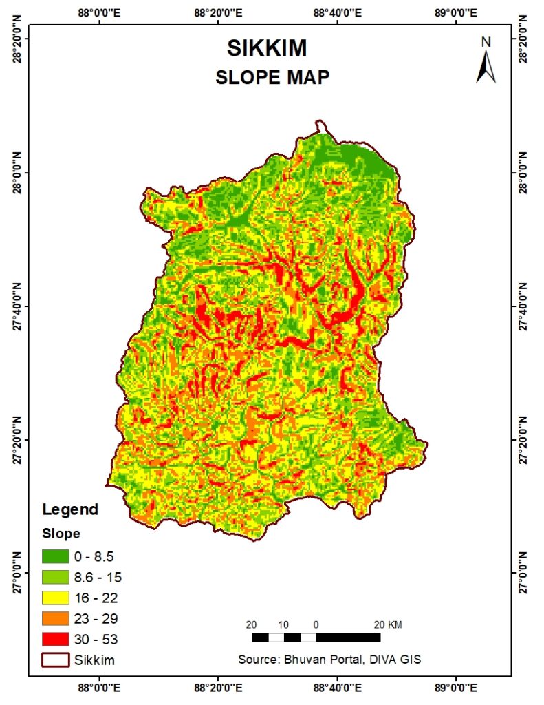
Sikkim, a picturesque state nestled in the Eastern Himalayas, is renowned for its stunning landscapes, diverse flora and fauna, and rich cultural heritage. One of the essential tools for understanding the geographical and topographical intricacies of this region is the slope map. In this blog post, we will delve into the significance of the slope
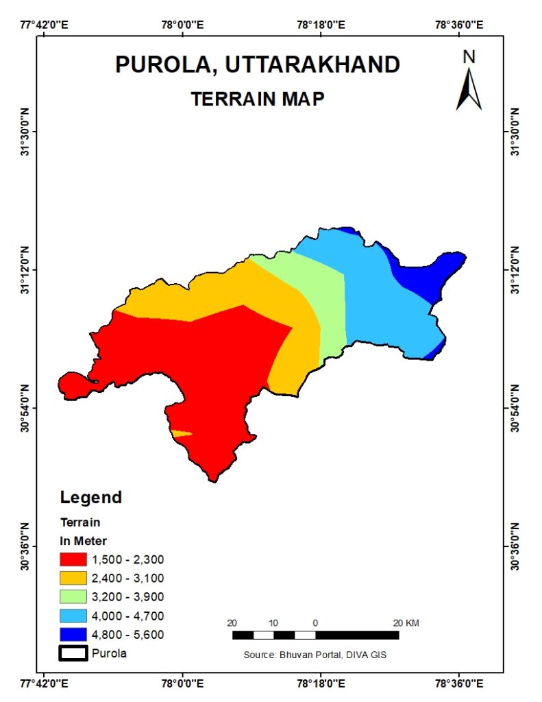
Nestled in the picturesque hills of Uttarakhand, Purola is a serene town that boasts breathtaking landscapes and a diverse topography. Understanding the terrain of Purola is crucial for various purposes, including urban planning, disaster management, environmental conservation, and tourism development. Geographic Information Systems (GIS) play a pivotal role in creating detailed and interactive terrain maps
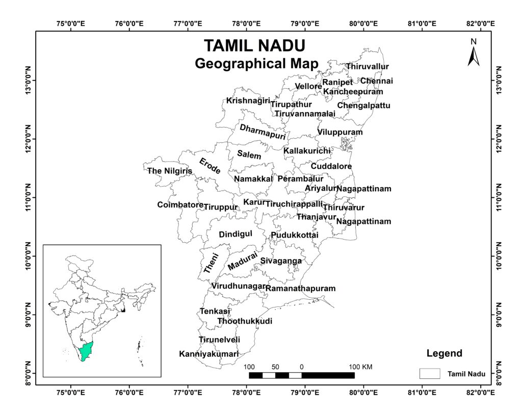
Tamil Nadu, located in the southern part of India, is a state known for its rich cultural heritage, vibrant traditions, and robust economic activities. Understanding the administrative divisions of Tamil Nadu is crucial for effective governance, resource management, and developmental planning. Thanks to Geographic Information Systems (GIS), we now have advanced tools to create detailed

Introduction: In the digital age, Geographic Information Systems (GIS) have emerged as indispensable tools for urban planners, revolutionizing the way cities are designed, managed, and developed. From optimizing infrastructure to enhancing sustainability efforts, GIS offers a plethora of applications that empower planners to make informed decisions backed by spatial data analysis. In this article, we
In an era where data drives decision-making, Geographic Information Systems (GIS) have emerged as a critical tool for spatial analysis and mapping. Whether you are an urban planner, environmental scientist, or data analyst, mastering GIS can significantly enhance your professional capabilities. Swastik EduStart offers a premier GIS online training program designed to equip you with
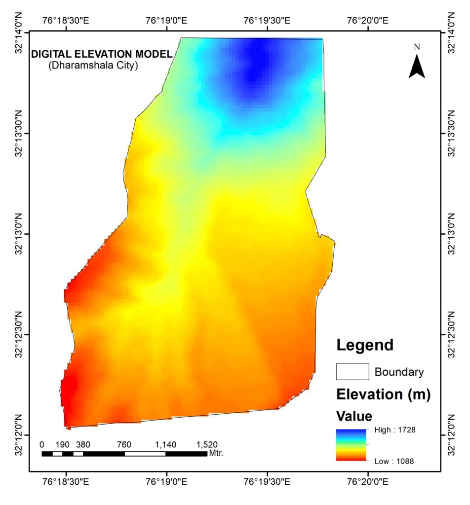
Welcome to our comprehensive GIS exploration of the Digital Elevation Model (DEM) of Dharamshala, Himachal Pradesh. In this blog post, we’ll take an in-depth look at the DEM data of Dharamshala and explore how Geographic Information Systems (GIS) technology enables us to gain valuable insights into the region’s terrain, elevation, and geographical features. Join us
Hillshade Map from DEM, Geographic Information Systems (GIS) have revolutionized the way we visualize and analyze geographical and topographical data. One powerful tool in GIS is the hillshade map, which provides a stunningly detailed view of the terrain by simulating the effect of sunlight on the landscape. In this blog post, we’ll explore how Digital
The term “total carbon” refers to the sum of all forms of carbon present in a sample. In environmental science and chemistry, understanding and measuring total carbon is crucial for various analyses, such as assessing pollution levels, studying ecological health, and monitoring climate change. Total carbon can be divided into several categories: Measurement Methods Several