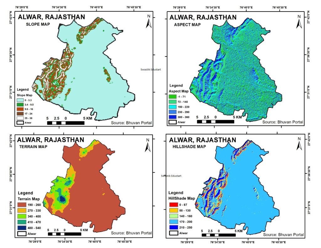
Creating a Hillshade Map from DEM Data: A Case Study of Alwar, Rajasthan
Hillshade Map from DEM, Geographic Information Systems (GIS) have revolutionized the way we visualize and analyze geographical and topographical data. One powerful tool in GIS is the hillshade map, which provides a stunningly detailed view of the terrain by simulating the effect of sunlight on the landscape. In this blog post, we’ll explore how Digital […]