Location Map – Dharamshala, Himachal Pradesh
Whether you’re exploring a new city or finding your way around a massive shopping mall, maps are your guiding light. But have you ever come across a location map and wondered how it differs from a regular map? Let’s dive in and uncover what location maps are all about! If you have any query related
Location Map
Whether you’re exploring a new city or finding your way around a massive shopping mall, maps are your guiding light. But have you ever come across a location map and wondered how it differs from a regular map? Let’s dive in and uncover what location maps are all about! What is a Location Map? A
News & Updates
What is Remote Sensing?
Remote sensing is a powerful tool that allows us to study the Earth from a distance, gathering information without direct physical contact. It involves the use of various technologies to collect data about the Earth’s surface, atmosphere, and oceans. What is Remote Sensing? Remote sensing is the process of obtaining information about an object or
News & Updates
Exploring India: A Guide on How to Download the Indian Map
Subtitle: Unlocking Access to India’s Geography in a Few Simple Steps India, known for its rich cultural heritage, diverse landscapes, and historical significance, is a vast country with an intricate geographical layout. For various purposes, obtaining a map of India can be incredibly helpful, whether for educational, travel, or informational reasons. Here’s a simple guide
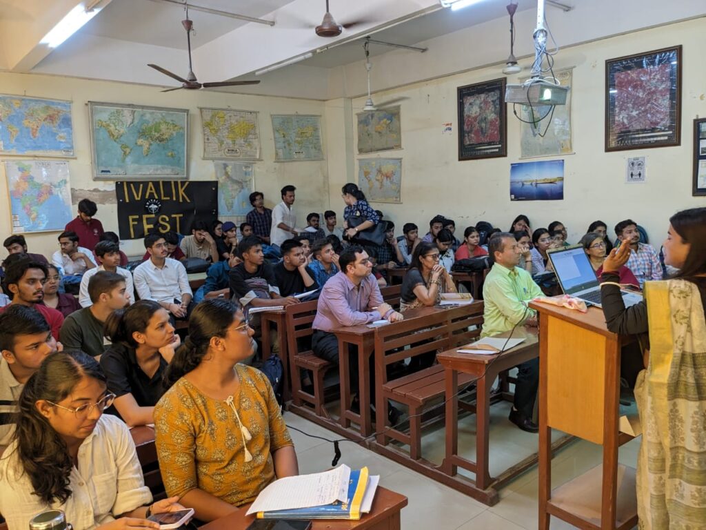
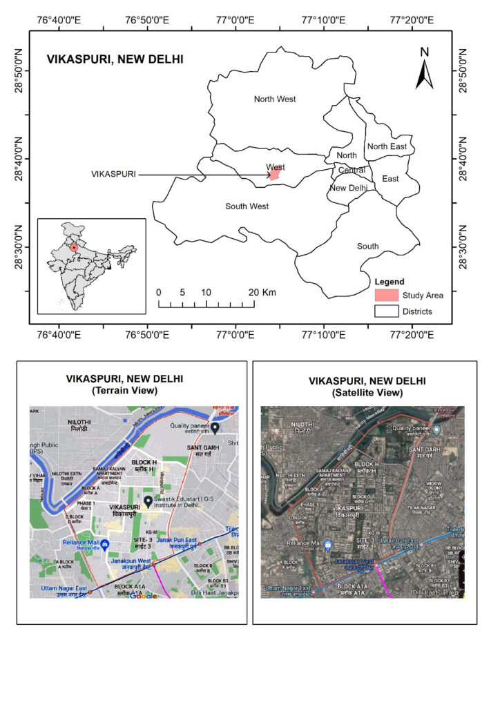
Learning Together: Exploring GIS Workshop at Shivaji College
Previous slide Next slide Highlights Topic : Career in GIS Date : 31.10.2023 College : Shivaji College I had a fantastic time at Shivaji College, Delhi University, on October 31st, 2023! We dived deep into the world of Geographic Information Systems (GIS) during a one-day session held at the Geography Department. It was all about
News & Updates
Hello world!
Welcome to WordPress. This is your first post. Edit or delete it, then start writing!