Webinar on Flood Risk Assessment using QGIS
Summary Report Topic Flood Risk assessment Using QGIS Date 14. 01.2024 (Sunday) Mode Webinar (Google Meet) Registration Free
Summary Report Topic Flood Risk assessment Using QGIS Date 14. 01.2024 (Sunday) Mode Webinar (Google Meet) Registration Free
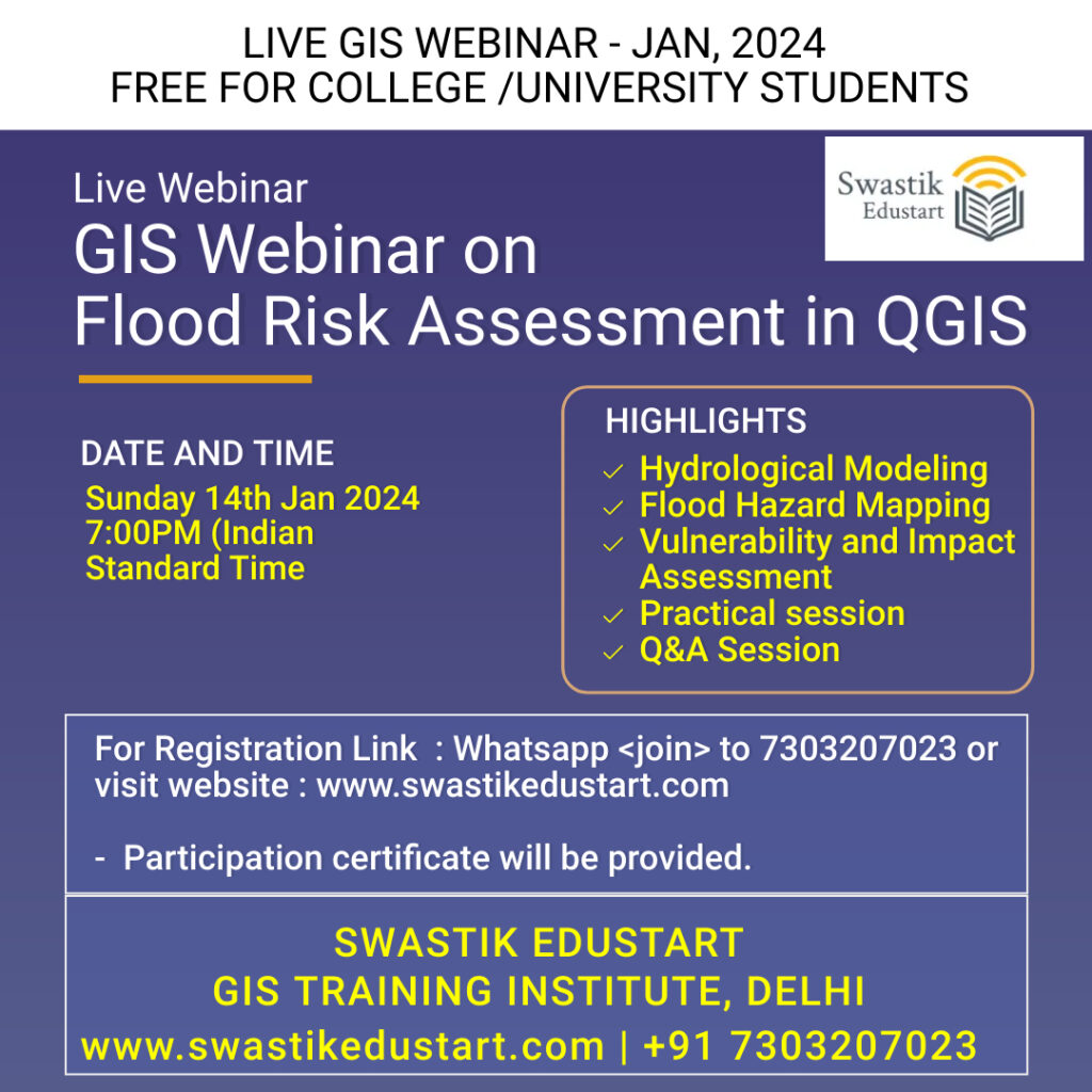
Registration Link : https://forms.gle/JsMhFro1tFMsW5326 GIS Webinar Flood Risk Assessment in QGIS ☑ Date: 14.01.2024 (Sunday) ☑ Time : 7:00PM (Indian Standard Time ☑ Ecertificate will be provide to participants No Registration Charges
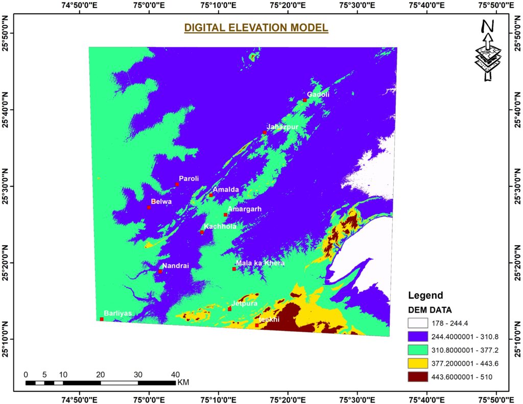
A Digital Elevation Model (DEM) is a digital cartographic dataset that represents a continuous topographicelevation surface through a series of cells. Each cell represents the elevation (Z) of a feature at its location (Xand Y). Digital Elevation Models are a “bare earth” representation because they only contain informationabout the elevation of geological (ground) features, such
Delhi is the National Capital Territory and it is bordered by Haryana on three sides and by Uttar Pradesh in the east. It is located at North Latitude from 28.24 – 28.53 degrees and East Longitude from 76.50 – 77.20 degrees. Delhi covers an area of 1483 Km2, of which 369.35 sq. Km. is designated
Kalpa, nestled in the heart of the majestic Himachal Pradesh, is a hidden gem waiting to be explored. This quaint Himalayan village is renowned for its breathtaking landscapes, serene atmosphere, and, of course, the captivating slopes that adorn its surroundings. In this blog, we’ll delve into the allure of Kalpa’s slop map, uncovering the natural
VECTOR ANALYSIS Single layer analysis techniques include selecting by attributes and calculating new attribute values with the field calculator. Many vector analysis techniques involve overlaying two or more datasets and using their spatial relationship to alter or create attributes and/or entities. Vector data analysis uses the geometric objects of point, line, and polygon. The accuracy

Miraculous Rescue in Silkyara Tunnel, Uttarkashi (Uttarakhand) Certainly! It’s great to hear that a worker has been rescued from the Silkyara Tunnel in Uttarkashi. The location map shows where the rescue took place. The worker is now safe and sound.