Webinar at GB pant university of agriculture and technology, Pantnagar
https://nahep.icar.gov.in/API/Content/Uploads/57ddc06a-455a-4d48-ab39-e4595f8afcf8/57ddc06a-455a-4d48-ab39-e4595f8afcf8brochure.pdf
Your blog category
https://nahep.icar.gov.in/API/Content/Uploads/57ddc06a-455a-4d48-ab39-e4595f8afcf8/57ddc06a-455a-4d48-ab39-e4595f8afcf8brochure.pdf
Organized by Swastik Edustart – Geospatial Training Institute, New Delhi. 5. Online – Faculty Development Programme (FDP) Read More
Read More https://www.kalindicollege.in/wp-content/uploads/2020/12/Geo-society-report.docx.pdf
EVENTS ORGANIZED BY THE DEPARTMENT OF GEOGRAPHY IN 2022-23 Read More https://www.shivajicollege.ac.in/uploads/department/geography/EVENTS%20ORGANISED%20BY%20THE%20DEPARTMENT%20OF%20GEOGRAPHY%20IN%202022%20(1).docx.pdf
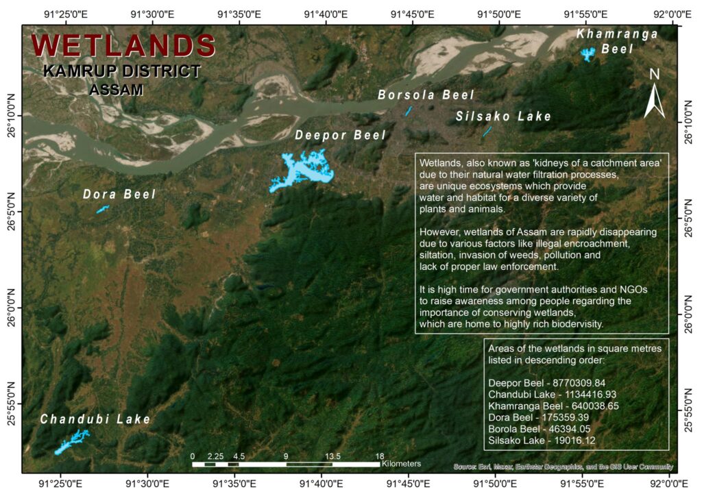
Kamrup district in Assam is home to a diverse array of wetlands that play a crucial role in maintaining ecological balance, supporting biodiversity, and sustaining the livelihoods of local communities. Wetland mapping is an essential process for understanding these valuable ecosystems and ensuring their conservation and sustainable use. In this blog post, we will explore
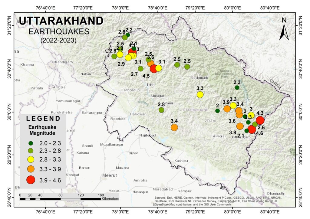
he state of Uttarakhand in India is known for its picturesque landscapes and serene environment. However, it is also situated in a seismically active region, making it prone to earthquakes. The Uttarakhand Earthquake of 2022-23 has once again highlighted the vulnerability of this region. In this blog post, we will delve into the details of

Object-based or object-oriented classification represents a significant advancement in the field of remote sensing and image analysis. Unlike traditional pixel-based classification methods, object-based classification leverages both spectral and spatial information, offering a more nuanced and accurate categorization of pixels. This approach closely mimics the way humans interpret visual information, considering not just individual pixel values
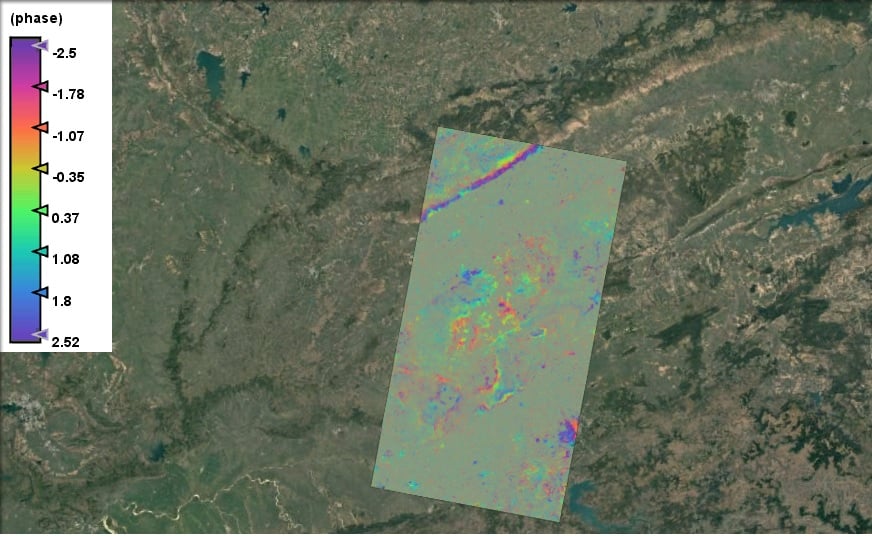
Land subsidence is a critical issue affecting many regions worldwide, often resulting from natural processes or human activities such as groundwater extraction, mining, or construction. Monitoring and understanding these changes are vital for urban planning, infrastructure maintenance, and environmental conservation. Our student Kartikey has taken a significant step in this direction by creating an interferogram

The Soil Moisture Index (SMI) for Udaipur Kotra Taluka has been meticulously prepared using the formula (NIR – SWIR) / (NIR + SWIR), where NIR (Near-Infrared) and SWIR (Short-Wave Infrared) reflectance values are employed to derive the moisture content in the soil. This index is instrumental in identifying and visualizing variations in soil moisture levels
Today, we join the global community in celebrating World Environment Day, a day dedicated to raising awareness and encouraging action for the protection of our precious planet. At Swastik Edustart GIS Training Institute, we believe that education and technology play a pivotal role in fostering a sustainable future. Through our GIS training programs, we empower