GIS Workshop at Kalindi College (Delhi University) GIS Workshop at Kalindi College (Delhi University) Read More »
GIS Workshop at Shivaji college (Delhi University) GIS Workshop at Shivaji college (Delhi University) Read More »
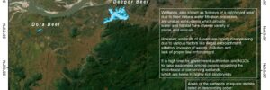
Wetland Mapping of Kamrup District, Assam: A Detailed Analysis Wetland Mapping of Kamrup District, Assam: A Detailed Analysis Read More »
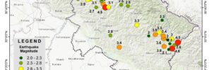
Mapping the Uttarakhand Earthquake 2022-23: A Comprehensive Analysis Mapping the Uttarakhand Earthquake 2022-23: A Comprehensive Analysis Read More »
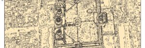
Mapping Object-Based Classification: A Comprehensive Guide Mapping Object-Based Classification: A Comprehensive Guide Read More »
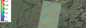
Monitoring Land Subsidence in Jabalpur: Interferogram Using Sentinel-1 SAR Imagery Monitoring Land Subsidence in Jabalpur: Interferogram Using Sentinel-1 SAR Imagery Read More »