Admission 2023-24
Apply Now Steps to apply Step 1: Get application form online/ offline (Call : +91 7303207023) Fill application form and submit ( Limited Seats in offline classes)- Admission on the […]
Your blog category

Apply Now Steps to apply Step 1: Get application form online/ offline (Call : +91 7303207023) Fill application form and submit ( Limited Seats in offline classes)- Admission on the […]
Webinar at GB pant university of agriculture and technology, Pantnagar Read More »
https://nahep.icar.gov.in/API/Content/Uploads/57ddc06a-455a-4d48-ab39-e4595f8afcf8/57ddc06a-455a-4d48-ab39-e4595f8afcf8brochure.pdf
Faculty Development Program at Miranda House College (Delhi University) Read More »
Organized by Swastik Edustart – Geospatial Training Institute, New Delhi. 5. Online – Faculty Development Programme (FDP) Read More
GIS Workshop at Kalindi College (Delhi University) Read More »
Read More https://www.kalindicollege.in/wp-content/uploads/2020/12/Geo-society-report.docx.pdf
GIS Workshop at Shivaji college (Delhi University) Read More »
EVENTS ORGANIZED BY THE DEPARTMENT OF GEOGRAPHY IN 2022-23 Read More https://www.shivajicollege.ac.in/uploads/department/geography/EVENTS%20ORGANISED%20BY%20THE%20DEPARTMENT%20OF%20GEOGRAPHY%20IN%202022%20(1).docx.pdf

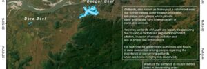
Wetland Mapping of Kamrup District, Assam: A Detailed Analysis Read More »
Kamrup district in Assam is home to a diverse array of wetlands that play a crucial role in maintaining ecological balance, supporting biodiversity, and sustaining the livelihoods of local communities.