Object-based or object-oriented classification represents a significant advancement in the field of remote sensing and image analysis. Unlike traditional pixel-based classification methods, object-based classification leverages both spectral and spatial information, offering a more nuanced and accurate categorization of pixels. This approach closely mimics the way humans interpret visual information, considering not just individual pixel values but also the context and relationships between pixels.
Understanding Object-Based Classification
Object-based classification involves two primary steps: segmentation and classification. Here’s a detailed look at each step:
- Segmentation: The initial step involves dividing the image into meaningful objects or features. These objects are groups of pixels that share similar spectral characteristics, such as color, as well as spatial attributes like size, shape, and texture. This segmentation process creates a set of image objects that serve as the basic units for further analysis.
- Classification: Once the image is segmented, each object is then classified based on its spectral and spatial characteristics. This step incorporates information from the surrounding pixels, enhancing the accuracy of the classification.
Advantages of Object-Based Classification
Object-based classification offers several advantages over traditional pixel-based methods:
- Incorporation of Spatial Information: By considering the spatial relationships and context of pixels, object-based classification provides a more comprehensive understanding of the image data.
- Improved Accuracy: The method reduces the salt-and-pepper effect common in pixel-based classification, leading to more accurate and visually appealing results.
- Versatility: This approach can handle complex scenes with varying textures and patterns, making it suitable for diverse applications such as urban planning, agriculture, and environmental monitoring.
Key Components of Object-Based Classification
Several factors play a crucial role in the success of object-based classification:
- Spectral Characteristics: The color or reflectance values of the pixels within an object are critical for distinguishing between different classes.
- Shape: The geometric shape of the objects helps in identifying features such as buildings, roads, or natural formations.
- Texture: The surface texture within the objects, defined by the variation in pixel values, aids in differentiating between rough and smooth surfaces.
- Spatial Context: The relationship between adjacent objects and their surroundings provides additional information that enhances classification accuracy.
Applications of Object-Based Classification
The versatility of object-based classification makes it applicable across various domains:
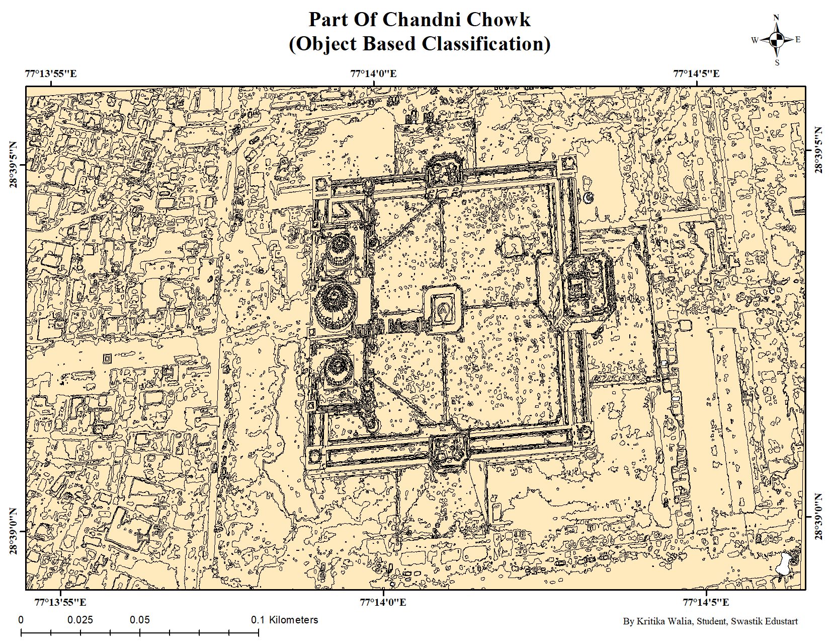
- Urban Planning: Accurately mapping urban areas, identifying land use patterns, and monitoring changes over time.
- Agriculture: Classifying crop types, assessing crop health, and optimizing agricultural practices.
- Environmental Monitoring: Tracking deforestation, land degradation, and habitat changes to support conservation efforts.
Conclusion
Object-based classification represents a significant evolution in remote sensing and image analysis, offering a more detailed and accurate approach to categorizing pixels. By integrating spectral and spatial information, this method mimics human visual interpretation, resulting in superior classification results. Whether for urban planning, agriculture, or environmental monitoring, object-based classification provides a powerful tool for extracting meaningful information from complex imagery.
Embrace the power of object-based classification to unlock deeper insights and achieve more accurate mapping in your projects.