Table of Contents
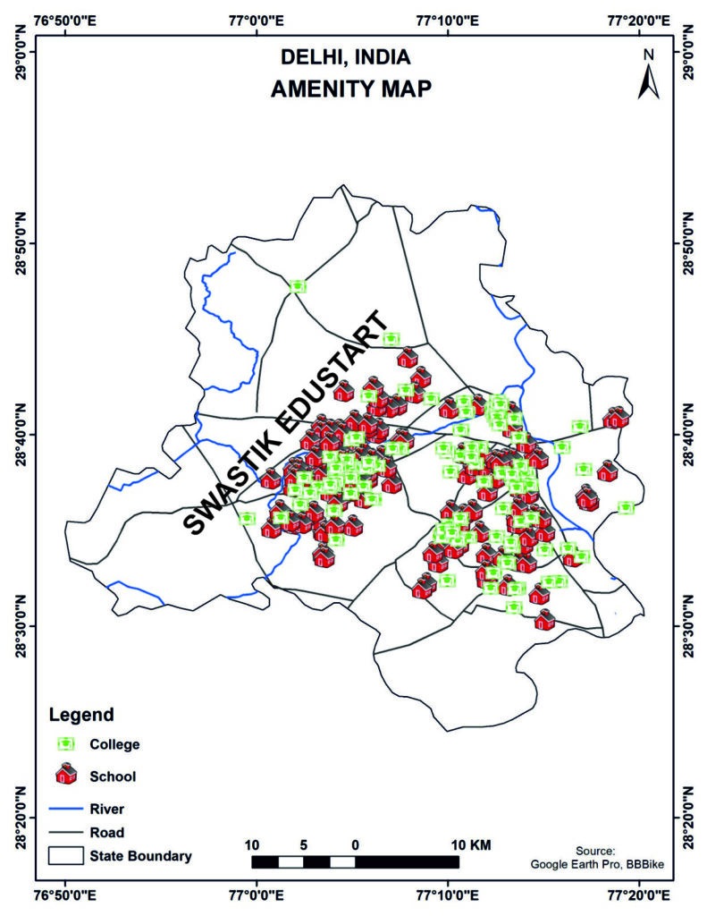
Delhi, the vibrant capital of India, is a city defined by its diversity, rich history, expanding neighborhoods, and rapidly evolving infrastructure. One of the most effective ways to understand a city’s spatial distribution of services is through an Amenity Map. The Amenity Map of Delhi provides a visual representation of essential facilities—particularly schools, colleges, roads, river networks, and administrative boundaries—helping planners, researchers, students, and residents understand how resources are distributed across the city.
With the help of GIS (Geographic Information Systems), the Amenity Map becomes more than a simple illustration—it transforms into a powerful tool for urban planning, decision-making, accessibility analysis, and infrastructure assessment.
What Is an Amenity Map?
An Amenity Map is a cartographic representation that visualizes the presence and distribution of public facilities, such as educational institutions, healthcare centers, transportation networks, and other services.
Why the Amenity Map of Delhi Matters
This map is significant for:
– Quality of Education
– Urban Planning and Transport Connectivity
– Identifying Infrastructure Gaps
– Disaster & Emergency Planning
Interpreting the Delhi Amenity Map
Key elements include:
– Distribution of Schools
– Distribution of Colleges
– Roads & Rivers
Applications of Delhi’s Amenity Map
– Urban Development
– Disaster Management
– Transportation Planning
– Educational Research
– Real Estate Insights
Hashtags:
#DelhiAmenityMap #DelhiGIS #UrbanPlanningDelhi #GISMapping #EducationalInfrastructure #DelhiSchools #DelhiColleges #GeospatialAnalysis #MapVisualization #ArcGIS #QGIS